| Statistic | West Minnehaha | Vancouver | Washington |
| Population | 4,251 | 182,792 | 7,614,893 |
| Population density (sq mi) | 1,398 | 3,750 | 117 |
| Median age | 38.2 | 37.1 | 37.6 |
| Male/Female ratio | 1.1:1 | 1.0:1 | 1.0:1 |
| Married (15yrs & older) | n/a | 53% | 56% |
| Families w/ Kids under 18 | 47% | 46% | 44% |
| Speak English | n/a | 80% | 81% |
| Speak Spanish | n/a | 10% | 8% |

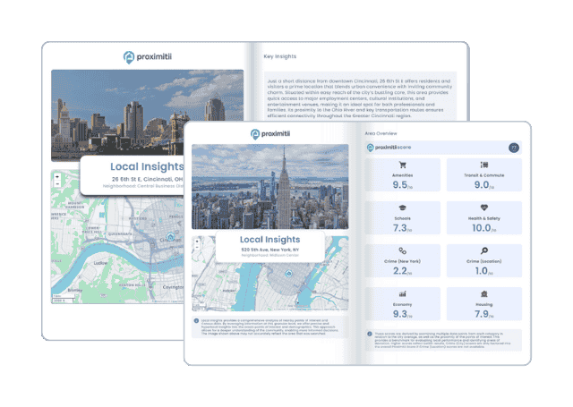
Why stop at city-to-city? With Local Insights, you can compare neighborhoods, zip codes, or even exact addresses. Access 300+ hyperlocal data points—from schools and crime to housing and amenities—to see which area is the better fit.
| Race | West Minnehaha | Vancouver | Washington |
| White | 78.33% | 78.10% | 77.34% |
| Black | 2.81% | 2.21% | 3.63% |
| Asian | 1.28% | 5.69% | 7.80% |
| American Indian | 0.43% | 0.43% | 1.33% |
| Native Hawaiian | 3.19% | 1.60% | 0.63% |
| Mixed race | 11.69% | 7.46% | 5.34% |
| Other race | 2.27% | 4.51% | 3.92% |


 Here are the best places to live in Washington
 Safest States In The US
 Check out the 10 safest cities in Washington
 Most Dangerous States In The US