Statistic Ashland Ridge Kansas City Missouri
Population 1,525 491,158 6,137,428
Population density (sq mi) 2,670 1,561 90
Median age 33.8 35.4 38.3
Male/Female ratio 0.8:1 0.9:1 1.0:1
Married (15yrs & older) n/a 46% 57%
Families w/ Kids under 18 65% 45% 42%
Speak English n/a 88% 94%
Speak Spanish n/a 7% 3%
See Who Lives in the Area Before Buying! Local Insights Report
  • Know the community before you call it home
  • Get clear insights into age, income, education, etc.
  • Access over 300 data points for any address
Local Insights Report

Demographics Quick Facts

  • The population density in Ashland Ridge is 71% higher than Kansas City
  • The median age in Ashland Ridge is 5% lower than Kansas City
  • In Ashland Ridge 39.40% of the population is White
  • In Ashland Ridge 44.71% of the population is Black
  • In Ashland Ridge 0.00% of the population is Asian

Compare Kansas City, MO Demographics

City Image
    City Default Image
      vs
      Compare Neighborhoods & Addresses Local Insights Report

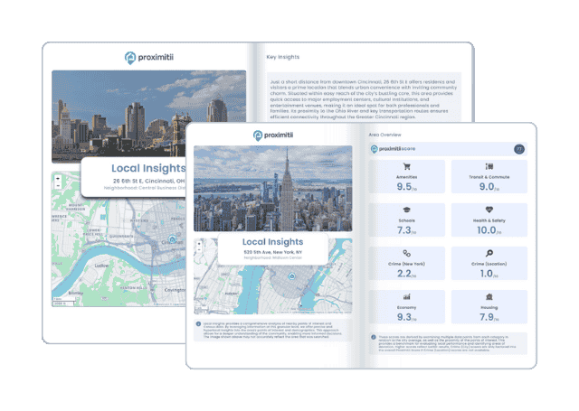
      Why stop at city-to-city? With Local Insights, you can compare neighborhoods, zip codes, or even exact addresses. Access 300+ hyperlocal data points—from schools and crime to housing and amenities—to see which area is the better fit.
      Local Insights Report

      Ashland Ridge racial demographics

      Race Ashland Ridge Kansas City Missouri
      White 39.40% 60.31% 82.53%
      Black 44.71% 27.66% 11.58%
      Asian 0.00% 2.78% 1.78%
      American Indian 0.00% 0.35% 0.42%
      Native Hawaiian 0.00% 0.25% 0.11%
      Mixed race 4.80% 4.78% 2.44%
      Other race 11.08% 3.86% 1.13%
      In Ashland Ridge, 10.6% of people are of Hispanic or Latino origin.
      Please note: Hispanics may be of any race, so also are included in any/all of the applicable race categories above.

      Household income distribution

      Place of birth by citizenship

      Ashland Ridge age breakdown

      Marital status

      Age of children in married couples

      Source: The Ashland Ridge, Kansas City, MO demographics data displayed above is derived from the United States Census Bureau American Community Survey (ACS).